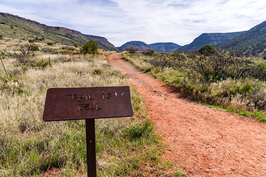
A red dirt hiking trail through grass toward the hillsPhoto: Coconino National Forest (CC0) · Wikimedia Commons

Outdoors · Cornville

Trails in Cornville

We list nine trails around Cornville, about 41 miles in all. They come from the U.S. Forest Service’s own trail records. Eight are in the Red Rock Ranger District of the Coconino National Forest, and one is in the Verde Ranger District of the Prescott National Forest.

Two long, the rest short: most of the miles are in two trails. The Forest Service measures the White Hills Loop at about 17.6 miles and the Lime Kiln Trail at about 15.2. The other seven are short, and three of them are under a mile. Before you start one of the long two, plan water and daylight, and know where you will come out.

What is underfoot: eight are dirt and rock. The Forest Service doesn’t record a surface for the last one.

Who can use them: the Forest Service records allowed uses for only one of the nine, so read the signs at the trailhead before you ride.

We don’t rate trails as easy or hard. The Forest Service doesn’t publish that for these trails.

Is a trail here closed, or listed wrong? Use the correct or remove link on its page.

Last verified

Sources

9 places on the map.

Open in Maps© OpenStreetMap contributors, Protomaps
Trails

Black Grama Loop is a loop route in the Cornville area of Arizona. It runs about 2.17 miles and stays fairly flat, with a grade of 0 to 5 percent. The tread is native material, so expect dirt, rock, and loose gravel rather than a paved path. It carries the number 1004 and a trail class of 3. The route lies in the Red Rock Ranger District of the Coconino National Forest. A loop returns to where it starts, so no second car or ride back is needed. Carry your own water, and look up closures and fire restrictions on the forest website before you drive out.

Verified Verified
Trails

Creosote Loop is a loop route in the Cornville area of Arizona, running about 1.3 miles. The grade stays between 0 and 5 percent, so it is close to level for its whole length. The tread is native material, meaning packed dirt and rock rather than pavement. It carries the number 1003 and a trail class of 3. The route lies in the Red Rock Ranger District of the Coconino National Forest. Because it loops, it ends where it began, which is handy with one car. Carry your own water, and check the forest website for closures and fire restrictions before you set out.

Verified Verified
Trails

Dog Leg Link Trail is a short connector in the Cornville area of Arizona. It runs about 0.51 miles, which is a few minutes of walking for most people. The grade is 0 to 5 percent, so it is close to flat. The tread is native material, meaning dirt and rock instead of pavement. It carries the number 1000C and a trail class of 3. The trail lies in the Red Rock Ranger District of the Coconino National Forest. A link trail joins longer routes, so it works as part of a bigger walk rather than on its own. Check the forest website for closures, and carry your own water.

Verified Verified
Trails

Elmerville Spur M Trail is a short spur in the Cornville area of Arizona. It runs about 1.33 miles and climbs at a grade of 5 to 8 percent, so there is some steady uphill. The tread is native material, so it is dirt and rock underfoot. It carries the number 115M and a trail class of 1. The route lies in the Red Rock Ranger District of the Coconino National Forest. A spur leads off a main route, so look at a map of the wider trail system before you set out. Bring a map you can read without a phone signal, and carry your own water.

Verified Verified
Trails

Grapevine Trail is a short route in the Cornville area of Arizona. It runs about 1.53 miles. The grade sits between 5 and 8 percent, so there is steady climbing in places. The tread is native material, which means dirt and rock rather than pavement. It carries the number 0543 and a trail class of 3. Hikers, horse riders, bicycles, and atv riders are all allowed, so watch for other users around blind corners. The route lies in the Verde Ranger District of the Prescott National Forest. Look up current conditions, closures, and fire restrictions on the forest website before you drive out, and carry your own water.

Verified Verified
Trails

Lime Kiln Trail is the longest trail listed here at 15.24 miles, near Cornville, in the Red Rock Ranger District of Coconino National Forest. It is trail number 82. The typical grade is 5 to 8 percent, moderate, which is the only reason a distance like that is walkable in a day at all. It is class 2, on native material. The allowed uses are not posted, so ask before you ride. Fifteen miles in this country is a water, heat and daylight problem before it is a fitness one. Plan it with the district office rather than from a map alone.

Verified Verified
Trails

Loy Link Trail is a short piece of trail in the Cornville area of Arizona, running about 0.82 miles. The grade is 0 to 5 percent, so it is nearly level the whole way. The surface is native material, which means packed dirt and rock rather than laid gravel or pavement. It carries the number 1004A and a trail class of 3. The Red Rock Ranger District of the Coconino National Forest manages it. Because it is a link, it is most useful joined to a longer walk. Look up conditions and closures on the forest website before driving out, and carry your own water.

Verified Verified
Trails

Tissaw Link Trail is a very short connector in the Cornville area of Arizona. It covers about 0.23 miles, so it takes only a few minutes to walk end to end. The grade is 0 to 5 percent, which is close to level. The surface is native material, so the tread is dirt and rock. It carries the number 1000B and a trail class of 3. It sits in the Red Rock Ranger District, part of the Coconino National Forest. Short links like this one join longer routes, so look at a map of the whole system before you set out. Check the forest website for closures, and carry water.

Verified Verified
Trails

White Hills Loop is a long loop in the Cornville area of Arizona, running about 17.6 miles. The grade stays between 0 and 5 percent, so it is a distance walk or ride rather than a climb. It carries the number 1020 and a trail class of 3. The Red Rock Ranger District of the Coconino National Forest manages the route. A day this long needs planning, so start early, carry plenty of water, and tell someone when you expect to be back. Look up closures, fire restrictions, and the weather on the forest website first, because conditions in open country change fast.

Verified Verified