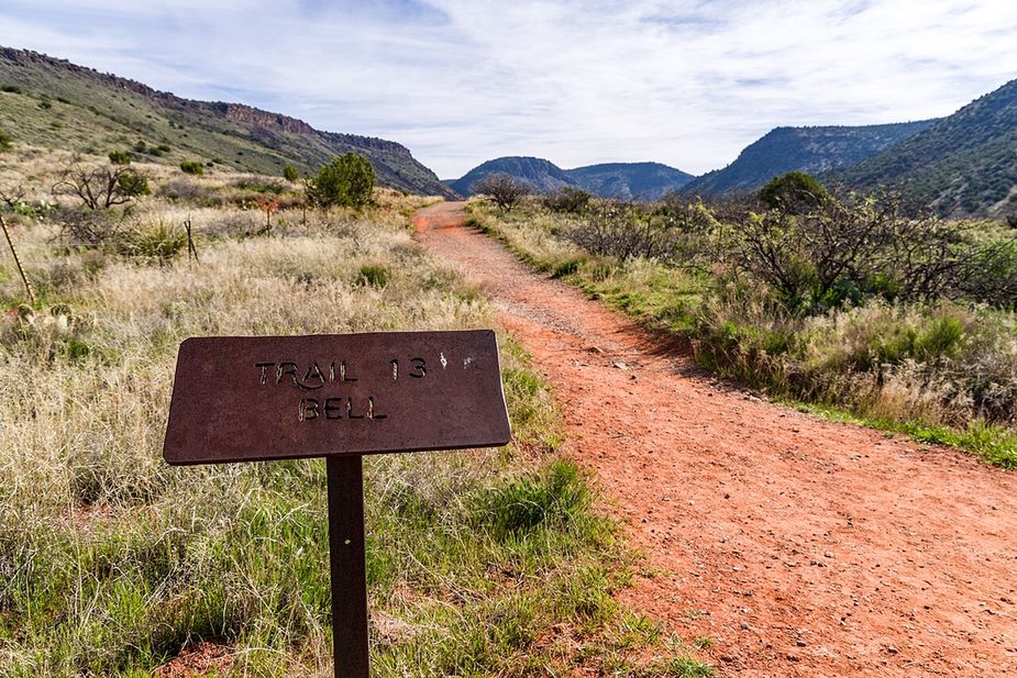
A red dirt hiking trail through grass toward the hillsPhoto: Coconino National Forest (CC0) · Wikimedia Commons

Outdoors · Clarkdale

Trails in Clarkdale

We list 16 trails around Clarkdale, about 88 miles in all. They come from the U.S. Forest Service’s own trail records, and they sit in three national forests: the Prescott, the Coconino and the Kaibab.

Longer than most: on average these are the longest trails we list for any town. None is under a mile, the middle of the list is almost four miles, and seven run past five. Two are much longer than that. The Forest Service measures the Sycamore Basin Trail at about 18 miles and the Great Western Trail at about 17. Plan water, daylight and a way back before you start one.

Who can use them: the Forest Service records what is allowed on 11 of the 16. All 11 allow hiking and horses, 7 allow bikes, and 2 are open to ATVs. Check the listing before you ride.

What is underfoot: 15 are dirt and rock. The Forest Service doesn’t record a surface for the last one.

We don’t rate trails as easy or hard. The Forest Service doesn’t publish that for these trails.

Is a trail here closed, or listed wrong? Use the correct or remove link on its page.

Last verified

Sources

16 places on the map.

Open in Maps© OpenStreetMap contributors, Protomaps
Trails

Bones Trail is 6.05 miles long on native material, so the tread is dirt and rock rather than gravel or pavement. Grades run 5 to 8 percent, which is a steady pull rather than a sharp climb, but the length adds up. It is rated trail class 2, meaning a built path that stays rough in places. The route is numbered 180 and falls under the Red Rock Ranger District of Coconino National Forest. Carry more water than you think you need, since there is no posted water along the way, and check with the ranger district for closures and current conditions before heading out.

Verified Verified
Trails

Deadman Pocket Trail runs 5.2 miles through the Bradshaw Ranger District of Prescott National Forest, near Clarkdale. It is trail number 0117. The typical grade is 12 to 20 percent, which is the steep end of what we list anywhere in the area, so treat the distance as slower than it looks on paper. Native material underfoot, class 2. Hiking and horses are the allowed uses. Bicycles are not listed. Carry more water than you think you need for a climb this sustained, and check the forest for closures before heading out, because district conditions change with weather and fire.

Verified Verified
Trails

Deadman Trail is short and steep. It covers 1.59 miles on native material, with grades in the 12 to 20 percent range, so the climbing is sustained for its length. The route is rated trail class 1, the roughest built class, meaning a faint and narrow tread in places where route finding matters. It is open to hiking, horseback riding and bicycles, and is numbered 29 under Kaibab National Forest. Sturdy footwear helps, and a trail map is worth carrying because a class 1 path can be easy to lose. Check with the forest for closures and conditions before you drive out.

Verified Verified
Trails

Dogie Trail covers 5.4 miles on native material, so the surface is dirt and rock the whole way. Grades run 5 to 8 percent, a steady grade rather than a steep one, though the distance makes it a half day for most walkers. It is rated trail class 2, a built path that stays rough in spots. The route carries number 116 and is managed by the Red Rock Ranger District of Coconino National Forest. There is no posted water, so carry your own and start early in warm months. Ask the ranger district about closures and current conditions before you go.

Verified Verified
Trails

Government Canyon Trail runs 1.6 miles near Clarkdale, in the Bradshaw Ranger District of Prescott National Forest. Its number is 0073. The typical grade is 0 to 5 percent, the flattest band we list, which makes this one of the easier walks in the set on paper. Native material underfoot, class 2. Hiking, horses and bicycles are the allowed uses. A short, gentle trail is a reasonable choice with children or an out of shape dog. Trailhead parking details are not posted or a water source for it, so check the district first.

Verified Verified
Trails

Great Western Trail is the long one here, at 16.8 miles on native material. Grades reach 10 to 12 percent, and the route is rated trail class 4, the most developed class, so the tread is wider and easier to follow than on a rough single track. It is open to hiking, horseback riding, bicycles and 4wd travel, which means you can meet vehicles along the way. The route is numbered 150 and sits under Kaibab National Forest. Plan fuel, water and daylight for the full length, or ride a section out and back. Check the forest for closures before heading out.

Verified Verified
Trails

Henderson Trail covers 4.4 miles near Clarkdale, in the Bradshaw Ranger District of Prescott National Forest, as trail number 0053. The typical grade is 0 to 5 percent, the flattest band are listed, which is unusual for a trail of this length here and makes the distance more approachable than it sounds. It is class 2, on native material. Hiking and horses are listed as allowed uses; bicycles are not. That combination often means a quieter trail. Trailhead directions and water information are not posted, so check with the district office before driving out, especially after storms.

Verified Verified
Trails

Lower Smasher Trail is a short route at 1.5 miles, with grades of 8 to 10 percent, so it climbs steadily without going on for long. It is rated trail class 3, a more developed class than most paths nearby, which usually means a clearer and wider tread that is easier to follow. The route carries number 88 and is managed by the Red Rock Ranger District of Coconino National Forest. Its length makes it workable as a quick outing or as a link to a longer day. Check with the ranger district for closures and current conditions before you go.

Verified Verified
Trails

Packard Trail covers 5.34 miles near Clarkdale, in the Bradshaw Ranger District of Prescott National Forest. It is trail number 0066. The typical grade is 10 to 12 percent, so there is real climbing spread across the distance. The tread is native material; the class is 2. Hiking and horses are listed as allowed uses, and bicycles are not, which usually makes for a quieter trail. At this length, plan for water and for the time of day you will be out in the open. Trailhead directions are not posted or parking details for it, so check with the district office first.

Verified Verified
Parsons Trail, Clarkdale Coconino National Forest (CC0-1.0)
Trails

Parsons Trail runs 3.3 miles on native material, with grades of 8 to 10 percent, so there is real climbing packed into a fairly short distance. It is rated trail class 2, a built path that still holds loose rock and uneven footing. The route is numbered 144 and is managed by the Red Rock Ranger District of Coconino National Forest. Footwear with grip helps on the steeper pitches. Carry water, because none is posted along the route, and plan turnaround time so you are not finishing in the dark. Check with the ranger district for closures and conditions first.

Verified Verified
Trails

RR Draw Trail runs 3.27 miles near Clarkdale, in the Bradshaw Ranger District of Prescott National Forest. It is trail number 0068. The typical grade is 10 to 12 percent, so expect sustained climbing rather than a level walk. It is class 2, on native material. Hiking, horses and bicycles are all listed as allowed uses. A draw is a drainage, which means this is a route that follows low ground and can change after storms. There is no listing for conditions or trailhead details, so check with the district office before heading out, especially in monsoon season.

Verified Verified
Trails

Rustbucket Trail covers 3.3 miles on native material, with grades of 8 to 10 percent, so the climbing is steady for the distance. It is rated trail class 2, which means a built tread that stays rough and uneven in places rather than a smooth path. The route is numbered 181A and falls under the Red Rock Ranger District of Coconino National Forest. Bring water, because none is posted along the way, and wear shoes with grip for the loose sections. Conditions change with weather and with fire restrictions, so ask the ranger district what is open before you drive out.

Verified Verified
Trails

Sob Canyon Trail runs 6.5 miles near Clarkdale, in the Bradshaw Ranger District of Prescott National Forest. It is trail number 9001. The typical grade is 8 to 10 percent across that distance, so the climbing adds up. Native material underfoot, class 3. Hiking, horses, bicycles and ATVs are all listed as allowed uses, so this is a shared canyon route and you may meet motorized traffic in it. Canyon routes change with storms and there is no listing for conditions. Check the district office before you drive out, particularly after heavy rain.

Verified Verified
Trails

Sycamore Basin Trail runs 18.19 miles near Clarkdale, in the Bradshaw Ranger District of Prescott National Forest. It is trail number 0063. That distance puts it among the longest routes we list, and the typical grade of 5 to 8 percent is what makes it walkable at all. Native material underfoot, class 2. Hiking, horses and bicycles are the allowed uses. At eighteen miles, water, heat and daylight decide the day, not fitness. This is a trip to plan with the district office and a map, not one to start on the strength of a listing page.

Verified Verified
Trails

Sycamore Trail runs 3.1 miles on native material, with no paving and no boardwalk. Grades sit in the 8 to 10 percent range, so expect steady climbing in places. The route is rated trail class 2, which means a built tread that is still rough in spots. It is open to hikers, riders on horseback, bicycles and atv use, so watch for others coming the other way. The trail is numbered 9033 and is managed by the Bradshaw Ranger District of Prescott National Forest. Check with the ranger district for current conditions, closures and any use limits before you drive out, because weather and fire can change access quickly.

Verified Verified
Trails

Yew Thicket Trail is 2.14 miles near Clarkdale, as trail number 0052. The typical grade is 5 to 8 percent, moderate for the distance, and the surface is native material. The recorded trail class is 2. Hiking and horses are the listed uses; bicycles are not. one caution about this page rather than the trail: the managing forest and the managing district listed for it do not match each other, so we are not stating either here until we can check which is right. That also means we cannot tell you which office to call. Look the trail number up before you go.

Verified Verified