Trails · Clarkdale

Deadman Pocket Trail

Length
5.2 mi
Surface
Native material
Trail class
2 of 5, moderately developed

About

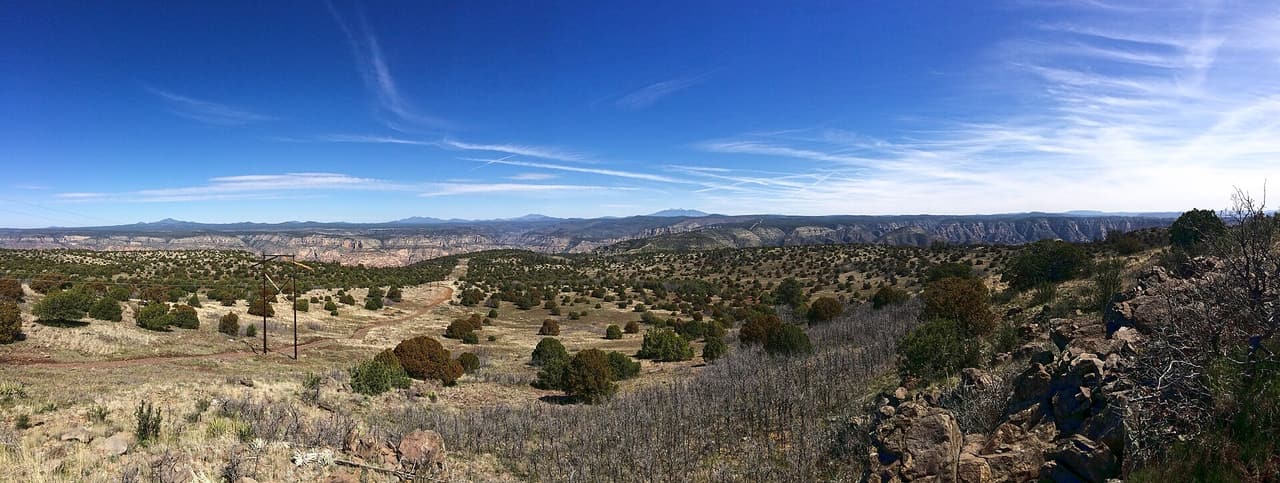
Deadman Pocket Trail runs 5.2 miles through the Bradshaw Ranger District of Prescott National Forest, near Clarkdale. It is trail number 0117. The typical grade is 12 to 20 percent, which is the steep end of what we list anywhere in the area, so treat the distance as slower than it looks on paper. Native material underfoot, class 2. Hiking and horses are the allowed uses. Bicycles are not listed. Carry more water than you think you need for a climb this sustained, and check the forest for closures before heading out, because district conditions change with weather and fire.

Last verified by open-data

0 Was this listing useful?
Reviews

What people say

Loading reviews…
Reader notes

Loading notes…

Nearby

Close to Deadman Pocket Trail

Clarkdale · Trails · 2.0 km

Deadman Trail is short and steep. It covers 1.59 miles on native material, with grades in the 12 to 20 percent range, so the climbing is sustained for its length. The route is rated trail class 1, the roughest built class, meaning a faint and narrow tread in places where route finding matters. It is open to hiking, horseback riding and bicycles, and is numbered 29 under Kaibab National Forest. Sturdy footwear helps, and a trail map is worth carrying because a class 1 path can be easy to lose. Check with the forest for closures and conditions before you drive out.

Verified Verified
Clarkdale · Trails · 2.3 km

Sycamore Basin Trail runs 18.19 miles near Clarkdale, in the Bradshaw Ranger District of Prescott National Forest. It is trail number 0063. That distance puts it among the longest routes we list, and the typical grade of 5 to 8 percent is what makes it walkable at all. Native material underfoot, class 2. Hiking, horses and bicycles are the allowed uses. At eighteen miles, water, heat and daylight decide the day, not fitness. This is a trip to plan with the district office and a map, not one to start on the strength of a listing page.

Verified Verified
Clarkdale · Trails · 5.6 km

Dogie Trail covers 5.4 miles on native material, so the surface is dirt and rock the whole way. Grades run 5 to 8 percent, a steady grade rather than a steep one, though the distance makes it a half day for most walkers. It is rated trail class 2, a built path that stays rough in spots. The route carries number 116 and is managed by the Red Rock Ranger District of Coconino National Forest. There is no posted water, so carry your own and start early in warm months. Ask the ranger district about closures and current conditions before you go.

Verified Verified
Clarkdale · Trails · 6.0 km

Henderson Trail covers 4.4 miles near Clarkdale, in the Bradshaw Ranger District of Prescott National Forest, as trail number 0053. The typical grade is 0 to 5 percent, the flattest band are listed, which is unusual for a trail of this length here and makes the distance more approachable than it sounds. It is class 2, on native material. Hiking and horses are listed as allowed uses; bicycles are not. That combination often means a quieter trail. Trailhead directions and water information are not posted, so check with the district office before driving out, especially after storms.

Verified Verified
Casner Mountain Trail, Sedona Coconino National Forest (CC BY-SA 2.0)
Sedona · Trails · 7.2 km

Look for trail 8 on forest signs and maps. That is Casner Mountain Trail, a route of roughly 6.88 miles inside the Coconino National Forest. The Red Rock Ranger District manages it. Underfoot it is native material: dirt and rock, not pavement. Slopes fall in the 8 to 10 percent band, and the route is rated trail class 3. Shade can be thin, so an early start makes the walk easier in hot months. Pack out everything you carry in, food scraps included. Temperatures swing a lot between morning and afternoon, so dress in layers.

Verified Verified
More

Also in Trails

All trails in Clarkdale →
Clarkdale · Trails

Bones Trail is 6.05 miles long on native material, so the tread is dirt and rock rather than gravel or pavement. Grades run 5 to 8 percent, which is a steady pull rather than a sharp climb, but the length adds up. It is rated trail class 2, meaning a built path that stays rough in places. The route is numbered 180 and falls under the Red Rock Ranger District of Coconino National Forest. Carry more water than you think you need, since there is no posted water along the way, and check with the ranger district for closures and current conditions before heading out.

Verified Verified
Clarkdale · Trails

Deadman Trail is short and steep. It covers 1.59 miles on native material, with grades in the 12 to 20 percent range, so the climbing is sustained for its length. The route is rated trail class 1, the roughest built class, meaning a faint and narrow tread in places where route finding matters. It is open to hiking, horseback riding and bicycles, and is numbered 29 under Kaibab National Forest. Sturdy footwear helps, and a trail map is worth carrying because a class 1 path can be easy to lose. Check with the forest for closures and conditions before you drive out.

Verified Verified
Clarkdale · Trails

Dogie Trail covers 5.4 miles on native material, so the surface is dirt and rock the whole way. Grades run 5 to 8 percent, a steady grade rather than a steep one, though the distance makes it a half day for most walkers. It is rated trail class 2, a built path that stays rough in spots. The route carries number 116 and is managed by the Red Rock Ranger District of Coconino National Forest. There is no posted water, so carry your own and start early in warm months. Ask the ranger district about closures and current conditions before you go.

Verified Verified