Trails · Sedona

Casner Canyon Trail

Length
3 mi
Surface
Native material
Trail class
2 of 5, moderately developed

About

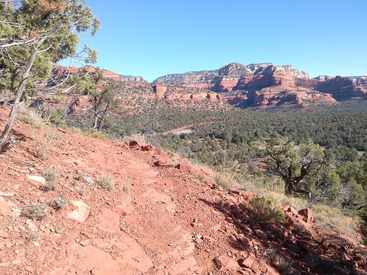
Casner Canyon Trail is a hiking trail near Sedona, Arizona. It is trail number 11 in the Coconino National Forest, and the Mogollon Rim Ranger District manages it. The trail is 3.0 miles long. It is steep in places, with a grade of 12 to 20 percent, so plan for a slow climb and bring plenty of water. The surface is native material, which means dirt and rock rather than pavement. It is rated trail class 2, a simple path with few built features, so expect uneven footing and wear sturdy shoes. Check with the ranger district for current trail conditions before you go.

Last verified by open-data

0 Was this listing useful?
Reviews

What people say

Loading reviews…
Reader notes

Loading notes…

Nearby

Close to Casner Canyon Trail

Sedona · Trails · 1.8 km

Allens Bend Trail is 0.45 miles near Sedona, in the Red Rock Ranger District of Coconino National Forest. It is trail number 111. Native material underfoot, at a typical grade of 5 to 8 percent. The trail class is 3, the most developed class are listed, which generally means a well defined tread. The allowed uses are not posted for this one, so ask before you ride. Under half a mile makes this a short walk rather than an outing, and short trails near Sedona are often busiest in the evening. Parking rules and fees are not posted for it, and those change, so check first.

Verified Verified
Sedona · Trails · 2.0 km

Wilson Mountain Spur D Trail is 0.29 miles near Sedona, in the Red Rock Ranger District of Coconino National Forest, as trail number 10D. It is another of the lettered spurs off the route numbered 10, and the shortest of those listed. Native material underfoot, at a typical grade of 5 to 8 percent. The trail class is 1, the least developed class. The allowed uses are not posted for this one, so ask before you ride. Read it on a map with the main climb.

Verified Verified
Sedona · Government · 2.2 km

One of the fire stations run by the Sedona Fire District, sitting at 3971 N Highway 89A in Sedona. Crews here answer fire and medical calls in the surrounding neighborhoods. The business line is (928) 282-6800, and that number is for questions, not for an emergency. Use the emergency number if someone is hurt or a fire is burning. The district website lists things residents commonly need, such as burn permit rules, inspection requests and safety programs. Station tours and public meetings are handled through the district rather than at the door, so call first. Staffing changes by shift, and crews may be out on a call.

Verified Verified
Sedona · Trails · 2.2 km

Wilson Mountain Spur a Trail covers 0.79 miles inside the Red Rock Ranger District of the Coconino National Forest, on the public land around Sedona, Arizona. The tread is dirt and rock left in place, and grades of 5-8% mean the miles climb gently. It carries the number 10A and is held to class 1 standards. Cool mornings are the easier time to walk it, and light fades quickly in the canyons. Sturdy shoes help, and so does an early start in summer. Ask the Red Rock Ranger District about current conditions and where you may park at the start.

Verified Verified
Sedona · Trails · 2.2 km

Oak Creek Spur a Trail is 0.32 miles near Sedona, in the Red Rock Ranger District of Coconino National Forest, as trail number 71A. It is another lettered spur off the route numbered 71, and a short one. Expect native material and a typical grade of 5 to 8 percent. The trail class is 1, the least developed are listed. The allowed uses are not posted, so ask before you ride. At a third of a mile on rough tread, this is a branch to know about rather than a trip to plan.

Verified Verified
More

Also in Trails

All trails in Sedona →
A B Young Trail, Sedona Coconino National Forest (CC0-1.0)
Sedona · Trails

A B Young Trail covers 2.09 miles near Sedona, in the Red Rock Ranger District of Coconino National Forest. It is trail number 100. The typical grade is 10 to 12 percent, which is steep enough that the mileage understates the effort, and the surface is native material. It is a class 2 trail. The allowed uses are not posted, so ask before you ride. This is a well known climb and it can be busy, so an early start helps with both parking and heat. Trailhead parking details are not posted, and parking rules around Sedona change, so check before you drive out.

Verified Verified
Sedona · Trails

Adobe Jack Trail is a 2.1 mile path in the Coconino National Forest near Sedona, Arizona. The Red Rock Ranger District takes care of it. The tread is native material, so you walk on packed dirt and rock rather than pavement. Grades run about 8 to 10 percent, which means steady short climbs rather than flat walking. It is listed as trail number 660 and rated trail class 2, a simple developed path with no pavement and no railings. Wear shoes with grip, carry more water than you think you need, and check the district for closures before you drive out to the trailhead.

Verified Verified
Aerie Trail, Sedona davidpinter (CC BY 3.0)
Sedona · Trails

Aerie Trail runs 2.75 miles over native dirt and rock in the Coconino National Forest outside Sedona. Grades sit between 5 and 8 percent, so the climbing is gentle and steady rather than steep. It is listed as trail number 168 and rated trail class 2, which means a developed path with a clear tread but no pavement and no railings. The Red Rock Ranger District manages it. Shade is thin on most trails in this country, so carry more water than you think you need, start early in warm months, and check for closures before you drive to the trailhead.

Verified Verified